 |
| Heading north from the campground - this is looking toward the bridge that would cross Lake Texoma. |
 |
| After we got onto I-35, there was a sign for a "Scenic Turnout".... uhm... scenic? This was looking west.... |
 |
| And this was looking east... I guess if windmills and communication towers are considered scenic? |
 |
| We made our way onwards and arrived at Turner Falls. |
 |
| Turner Falls is a 77' waterfall on the Honey Creek. |
 |
| It was really quite beautiful. |
 |
| Many of the areas were marked for swimming (like this pool right in front of the falls) - I'm sure on summer days, you would not get a picture with no people in it! |
 |
| Looking downstream below the falls. |
 |
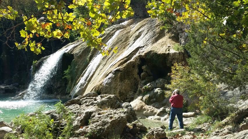
| A picture from the other bank. That round white thing under the falls/cave is a sign saying not to climb on the rock. |
 |
| My honey getting some pictures. |
 |
| Beautiful |
 |
| Right near the top, there was a plant that appeared to have a red bloom sticking straight off the rocks. |
 |
| It was rather warm by this point in the day - we wished we had our swim gear! |
 |
| We hiked up past a "castle" that had been built by a rancher in the area. |
 |
| Then we drove further into the park. We saw the RV sites ($25/night + the daily entry fee for each person). This was Honey Creek above the falls. |
 |
| Another view of Honey Creek. |
 |
| My honey getting a picture of Honey Creek! |
 |
| This is close to the top of the falls. |
 |
| Just beyond Dwayne, you might see a couple of very small people - they are in the pool at the base of the falls. |
 |
| A final picture from the overlook at the curio shop / zipline outside the park on route 77. Dwayne remembers getting cherry cider at the curio shop many many years ago (55 or so). |
No comments:
Post a Comment