Since we had to drive in to Warrenton to Astoria Airport to get the package yesterday, we decided to take in some of the sights of Astoria while we were there. From the airport, we could see Astoria Column, so we decided to start there as it was said to have a 360 degree view of the area.
 |
| We wanted a place to view the Astoria-Megler Bridge. We had crossed this bridge a couple of times - when we came over to Warrenton to shop, and then with Miss Doozie when we moved to Seaside. It is just over 4 miles long. |
https://en.wikipedia.org/wiki/Astoria%E2%80%93Megler_Bridge
 |
| There was a ship going out just as we got to the parking area for the column. As you may be able to tell, the channel is in the very southern part of the river, right by Astoria. The highest part of the bridge is right near its southern connection to land - so it has a loop that takes it down to ground level after it reaches the land. |
 |
| A view of the middle part of the bridge. |
 |
| The northern part of the bridge where it connects to Washington state. |
 |
| The ship was going under the bridge... |
 |
| A better close-up... |
 |
| And even more close-up |
 |
| This gives you an idea of where we were and where the bridge was. Where we are currently staying is along the coast just below the last city shown on the map. |
 |
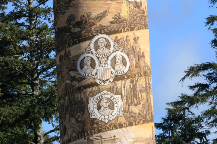
| Information derived from brochure at the column: The Astoria Column is part of a series of 12 historical markers erected in the early 1900s between St. Paul, Minnesota, and Astoria, Oregon. It is covered with paint and plaster carvings that decorate the Column exterior with a frieze of 22 significant events that occurred in the region. |
 |
| The base frieze is "Before the white man came", and also has a picture of Robert Gray who arrived in the ship Columbia Rediviva in 1792 (after which the river is named - Columbia). |
 |
| Just above him is a set of three pictures commemorating the Lewis and Clark expedition in 1805-1806 as well as Thomas Jefferson. |
 |
| Fort Clatsop was built by the expedition and where they lodged for the winter of 1805-1806. |
 |
| In 1810, John Jacob Astor sent an overland party toward the west from St Louis - which reached Astoria in 1812. |
I have to admit that I had not considered where the name of the city came from until I saw the information on the column... Wikipedia tells me that it was named after John Jacob Astor whose American Fur Company founded Fort Astoria here. (
https://en.wikipedia.org/wiki/Astoria,_Oregon) His great grandson, Vincent Astor, a New York philanthropist, aided in funding the building of the column.
 |
| The overland party crossed the Great Divide in January, 1812. |
 |
| Astor's "partners in the field" sold out to the Northwest Company in 1813. The state of Oregon was established in 1859. |
 |
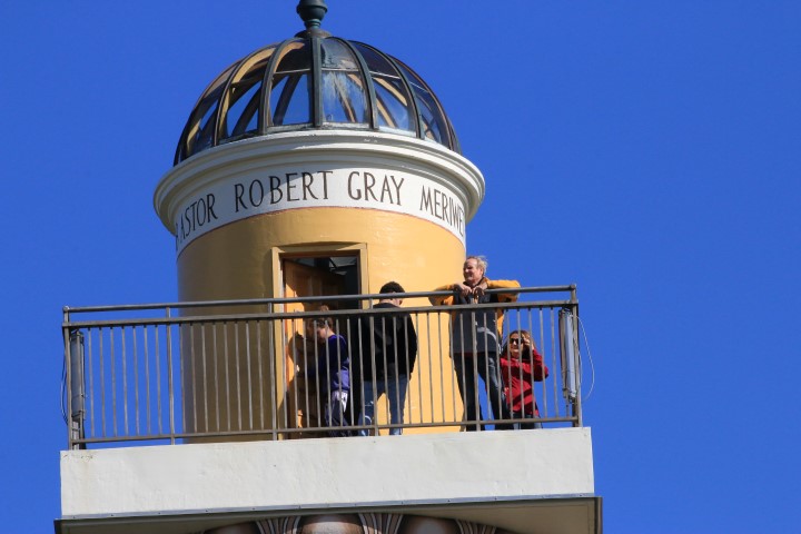
| You could go inside the column and take the 164 steps up to the top for a great overlook. |
 |
| The Astoria-Megler bridge from the top of the column... or at least the Columbia River where the bridge crosses, it isn't very easy to see the bridge in this picture. |
 |
| Some of the cargo ships in the river a little to the east of us. |
 |
| A panoramic view of Young's Bay to the far left (with the bridge leading to Warrenton), the town of Astoria right below, and the Columbia river to the right. |
 |
| Remember that boat that was going under the bridge in the pictures a few above? There it is heading out to the ocean. |
 |
| You can barely see the ship in front of the land in the distance on the left beyond the bridge. The ships must continue along the southern shore before turning back toward the northwest to exit the river. |
 |
| The steps as we were going down in the tower. |
If you are interested in seeing more pictures of the artwork on the side of the column, the Friends of Astoria Column have a good website with explanations here:
https://astoriacolumn.org/about/test-gallery/
The Astoria Column was a great place to visit. The price was $5 for a yearly pass for the vehicle (calendar year, so ours is only good for 3 months). We would highly recommend a visit if you are in this area!


No comments:
Post a Comment