We had started the Desert Voices Trail on Friday, but decided it was too hot for us (it was just after 9am and the temperature was already getting uncomfortably warm). So, on Saturday morning, we got up when Tabitha requested (demanded) breakfast, just before 6am, and got to the trailhead near the Split Mountain campground just before 7am.
 |
| The first sign told us that the length was 1.5 miles. |
 |
| A sign a few feet later provided a little information about the terrain we would cover... |
 |
| This sign told us that the length was 2 miles. |
I saw this graph on the way in... and had it in my head - I knew that it indicated that the trail got "very strenuous" in the summer, but for some reason I thought the axis on the bottom was on the duration of the hike - as we got further along, it got harder. I didn't notice that the axis showed time - from 6am to 6pm - along the bottom axis - until I looked at the photograph after we got back to the bus.
 |
| The trail had interesting information targeted specifically for children - or... I guess it was for children! |
 |
| At the beginning of the trail, we were in a wash, and the plants were quite lush for a desert landscape. |
 |
| We are within the Great Basin Desert. |
 |
| But it is known as a Cold Desert |
 |
| As we got further along the trail, the plants did not overhang the path as much (for which I was thankful because I had not worn long pants). |
 |
| I had never heard of cryptogamic soil before - sounds like something that a de-coder ring would help with! |
 |
| I had noticed the black coloring on the soil and thought it looked like a mold (which I guess it is like). |
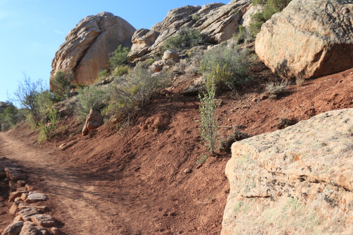
I don't have text to associate with most of the scenery pictures, so will just include them without captions for your enjoyment of the glory of God's creation...
 |
| This was at the spot where we could decide to stay on the Desert Voices loop or take a short connector trail to the Sound of Silence trail (which would mean our total hike would go from 1.5 or 2 miles to a 5 mile loop) - we elected NOT to do the longer hike! |
 |
| Nice to have clear signage. |
 |
| This was looking back the way we came - it says that the trailhead and Split Mountain Campground were 1 mile away - so we'd come 1 mile. |
 |
| Looking back down the path the way we came... we continued onwards on the Desert Voices loop. |
 |
| I thought that it was interesting that prairie dogs can "make their own" water (called metabolic). |
Turning to wikipedia for more information (
https://en.wikipedia.org/wiki/Metabolic_water):
Metabolic water refers to water created inside a living organism through their metabolism, by oxidizing energy-containing substances in their food. Animal metabolism produces about 100 grams of water per 100 grams of fat, 42 grams of water per 100 g of protein and 60 grams of water per 100 g of carbohydrate.
Some organisms, especially xerocoles, animals living in the desert, rely exclusively on metabolic water. Migratory birds must rely exclusively on metabolic water production while making non-stop flights. Humans, by contrast, obtain only about 8-10% of their water needs through metabolic water production.
 |
| This is an interesting picture - Google noticed that I had taken two pictures close together and created the panoramic photo for me - I thought it was really nice! It took me a while to figure out how to get it to the directory on my computer to be able to import it into the blog, but the creation of the panoramic shot was done for me! |
 |
| I knew that the federal government owns a lot of the land in the west, but I didn't know how it occurred - that states were given their choice for development and ultimately the federal government kept what was left. As shown at the bottom of the info-plaque, there are several different federal organizations who have responsibility for different areas. |
 |
| The mission of the National Park Service is preservation |
 |
| Other agencies manage the land for a variety of purposes. |
 |
| Since we were on the "Desert Voices" trail, and since the early sign encouraged us to be quiet and listen, we did... but what we heard most of were airplanes in the sky above us. I got this picture when the contrail was being illuminated by the sun and we were behind a rock shaded from the rising sun. |
 |
| This is an interesting graphic on the sources of water for the upper Green River. You can notice that the Yampa River does not have a reservoir or irrigation diversions - this was a point that we had read about in several places since we've been here at Dinosaur National Monument. In the mid 1900s, there was a proposal to dam the river within the park to create a lake and recreation area - the area that we visited a few days ago at Echo Park would have been under water. The determination was made that National Park land should not make that kind of change to the environment inside the national part (or monument). That decision impacted not just Dinosaur National Monument, but other lands managed by the National Park Service as well. |
 |
| It was not always clear to me when we were in National Park lands or lands managed by other federal agencies when we were on the Colorado side of the monument, but I guess the areas where cattle or sheep were grazing were either privately owned or leased from other federal agencies. |
 |
| Almost back to the trailhead! |
We walked down to the Green River boat ramp while we were in that area...
 |
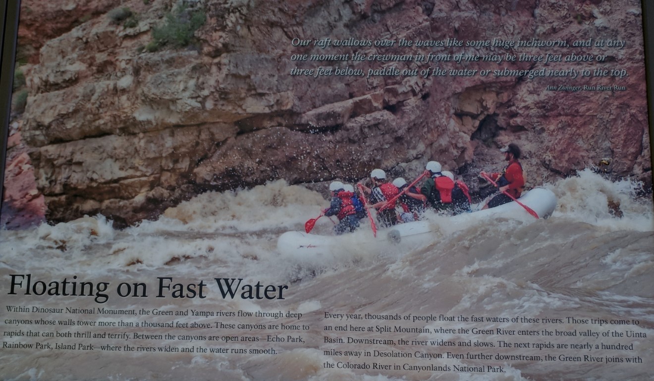
| This quote from John Wesley Powell: "... the scenery was on a grand scale, and never before did I live in such ecstasy for an entire month..." |
There were a number of trucks with trailers to transport rafts after they finish up their trips and end here at Split Mountain. I looked up a couple of them - one had "luxury" raft trips for 5 days / 4 nights on the Green River for the bargain price of $2300/adult (
http://www.griffithexp.com/luxury-expeditions) - but "luxury" is the only way I'm interested in camping! But I found another that had 1 day trips on the Green River for just $119/adult (
http://www.donhatchrivertrips.com/day-trips/splitmountaincanyon-itinerary.php). When I was reading about this, I remembered seeing some folks in front of the Visitor's Center when we arrived there on Friday that looked like they were ready to go rafting - they were waiting out front, and I bet there was a transportation vehicle that would come to take them to the put-in spot. I think I'm glad I didn't figure this out until our last day here at Dinosaur, because I think I may have been tempted to try to talk Dwayne into doing a one day rafting trip!
 |
| I thought that the glare from the sun actually made this an interesting photo - Dwayne is standing down the boat ramp near the river - you can just see his white cowboy hat. |
 |
| The Green River with Split Rock Mountain rising up out of it. |
 |
| Looking downstream down the Green River. |
We have enjoyed our visit to the Dinosaur National Monument. Planning to keep heading further west along US 40 on Sunday after enjoying our home church's livestream in the morning.


No comments:
Post a Comment